Wednesday, June 18, 2008

Alaskan Idyll, Day 1 - Dawson Creek, BC


We currently are at Dawson Creek, British Columbia, mile zero on the Alaska Highway. We are camped at Northern Lights, an unremarkable campground with no satellite TV, poor satellite radio, and iffy internet, on the outskirts of Dawson Creek, BC.

We arrived in Dawson Creek after a five day drive from Chimacum, Washington. Thursday morning, after retrieving Kathy from the Seattle Airport at midnite, we took the Port Townsend Ferry to Widbey Island and drove a short distance north to Camp Wal Mart, in Bellingham, WA. Friday we crossed the border and motored north through the beautiful Fraiser River Canyon, stopping for the night at Lac La Hache Provincial Park.


The Port Townsend Ferry


Windshield View of the Fraiser River Canyon


On Saturday, we drove 300 miles from Lac La Hache, through St. George, to Chetwynd, BC, where we paused for a couple of days to visit two nearby dams on the Peace River. In Chetwynd we stayed at a small campground named Westwind. It is a full service campground with free wifi and some spotty satellite TV reception.


The drive north to St. George from Lac La Hache was pastoral, with many farms and ranches. North of St. George, the landscape is much more remote as you start to view dense forest, interspersed with marshy areas. About 100 miles north of Prince George, the road turns east and crosses the spine of the Rocky Mountains, descending toward Chetwynd and Dawson Creek, on the edge of the great Canadian Prairie.


Crossing the Rockies

Rocky Mountain Flora


On Sunday we took a automobile ride to Hudson’s Hope, site of two major dams on the Peace River. These 2 dams supply 38% of the hydropower used in B.C. Our first stop was the WAC Bennett Dam, where for $3 each we had an excellent tour into the powerhouse and manifold chamber . WAC Bennett is a very large earthen dam that forms Williston Lake, which is a popular recreation area in northern BC.
WAC Bennett Dam and Williston Lake
Combination Water Turbine and Fish Filter from the Dam
Dam Wildlife
Rainclouds Invade the Peace River Canyon Downstream from the Dam

Our second stop was Peace Canyon Dam, which is a smaller concrete dam downstream a few miles from the WAC Bennett. The dam’s reservoir is called Dinosaur Lake. No tour is offered, but there is a visitor’s center as well as picnic facilities and a nice view of the dam.

In our travels we spotted several deer as well as one fawn (see above). The day started out sunny, but turned into a rainy afternoon with intermittent heavy downpours as we motored back to our home on wheels for our afternoon nap. The sound of rain on our roof was pleasant, and lulled us right to sleep.

The morning after our Dam visits we motor east about 60 miles to Dawson Creek, BC, which is mile zero on the Alcan (Alaska Highway). There we will rendezvous with our caravan for the long trek to Alaska. Stay tuned.
Dawson Creek, on the Edge of the Great Canadian Prairie

Tuesday, June 3, 2008

A Family Interlude in Seattle

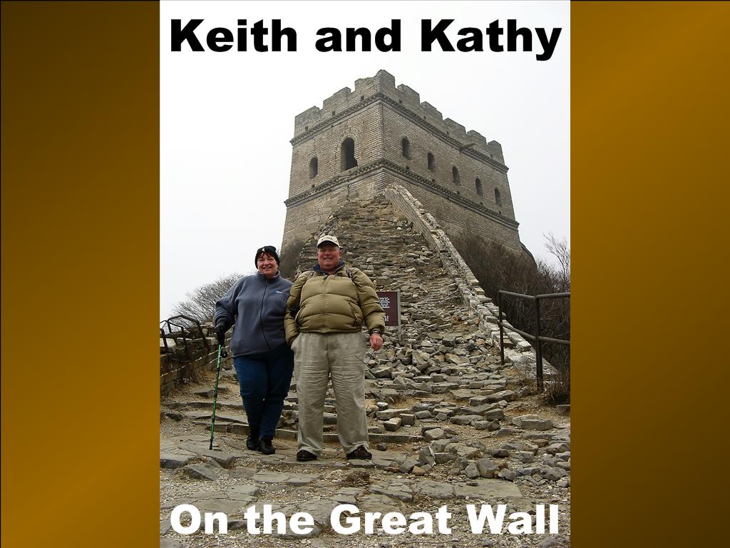
Where in the World are Keith and Kathy?


We recently spent a month in a beautiful Escapees Park in Chimacum, Washington, near Port Townsend. During this period we visited with our son, who is a graduate student at the University of Washington. Our daughter and one of our granddaughters flew out from Maryland to spend a long weekend with us, and we flew to Massachusetts a few days for Kathy’s parent’s 60th wedding anniversary. Kathy actually flew to Massachusetts twice, but that’s a different story.


Happy 60th Anniversary to Helen and Walter

Port Townsend is a quaint, somewhat artsy-fartsy town, with several Victorian era homes and commercial buildings. The downtown area includes many establishments which cater to the female visitor’s never ending thirst for retail therapy, as well as a couple of excellent Thai restaurants, and a terminal for the ferry to Whidbey Island. Our busy schedule limited our time to tour the town, but Keith did enjoy several good Thai meals during Kathy’s second visit to Massachusetts. We rate the Thai 1 2 3 restaurant in Port Townsend 3-3/4 COWs. There is no table service, but they will bring your meal to the table after ordering and paying at the counter. The benefit of this limited service is excellent food at reasonable prices, about 10 to 20 percent lower than typical for full service Thai. There also is a very good diner in Chimacum, where we enjoyed several excellent breakfasts.

We enjoyed several meals in the Seattle area with our son and his wife, including a couple of good Indian meals, as well Pho, which is a tasty Vietnamese rice noodle soup. We also had lunch at Chandlers, a upscale restaurant with waterfront seating on the southern tip of Lake Union.
Lunch at Chandlers


For our visit with the 4 year old granddaughter, we moved temporarily to the KOA in Kent, near the SeaTac airport. We seldom stay at KOA, because they are pricy and cater mostly to families, but it was perfect for this visit. Our granddaughter thoroughly enjoyed the heated KOA pool, and the playground. She also enjoyed her visit with Uncle Will and Aunt Larissa, who pitched their new tent in a nearby site. We cannot comment with certainty, but we hope she also enjoyed her visit with Grandpa and Babchi. We were sad to see them go, and will look forward to seeing them again in the fall.
Larissa in the KOA Pool With the Blossom


When Kathy was in Massachusetts, Keith had a couple of interesting submarine experiences. While crossing the Hood Canal he was stopped at the drawbridge, which was open for passage of the USS Alabama, a nuclear missile submarine leaving the Bangor Naval Submarine Base for Pacific patrol. He learned these details while chatting with a young lady who was standing on the roadside taking photographs, as her husband departing for duty on this vessel. Keith unfortunately did not take pictures, as he not have the camera.

A few days later, Keith visited the Naval Undersea Warfare Museum near Bremerton, Washington. This fine museum features many excellent and well interpreted displays on all aspects of undersea warfare including submarines, submariners, torpedoes, diving and submarine rescue technology, WWI and II submarine actions, etc. There also were excellent interpretive displays on weather, geology, ocean currents, and other geophysical topics related to undersea navigation. To Keith’s delight, there was even a display highlighting the role of materials advances in the evolving development of underwater capability.
Naval Undersea Warfare Museum
Nuclear Submarine Control Room


On 10 June, at midnite, Keith picked up Kathy at SeaTac airport, and the next day we took the ferry to Whidbey Island and drove north to Bellingham, WA, where we parked with 17 other RV’s at camp Wal Mart. This is an excellent stop, with plenty of RV parking away from the cars on the west side of the lot. The store is open 24 hours, and Keith shopped at 4am. Later in the morning we crossed the border and motored north through the beautiful Frasier River Canyon, stopping for the night at Lac La Hache Provincial Park. Our next destination is Dawson Creek, BC, where we rendezvous with our Alaska Caravan. More to follow.

Tuesday, May 6, 2008

Hoh Hoh Hoh Rain Forest

Where in the World are Keith and Kathy?


After our visit to Mt. St. Helens, we motored northwest to Kalaloch Campground in the Olympic National Park, where we found a campsite on a bluff overlooking the Pacific Ocean. We stayed four nights with no cell phone, internet, or satellite TV, but we were able to listen to the Tuesday evening election returns on the Sirius satellite radio. Sirius re-broadcasts the CNN and Fox news audio feeds, as well as two channels of NPR and CBC Radio 1. Keith did not especially miss the video feed, but by Friday, when we left, Kathy was showing definite signs of Stage II TV withdrawal.

View from the Picnic Table


It drizzled off and on for our four nights at Kalaloch, but that did not dampen our spirits. The light to moderate winds which brought the rain also brought a light to moderate surf, which made our days pass pleasantly, and soothed our sleep at night.

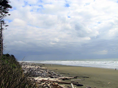
Directly behind our campsite, at the bottom of the bluff, were stacks of large tree trunks, strewn along the beach as far as the eye could see. These trees are brought down the streams and rivers from the Hoh Rain Forest, on the slopes of the Olympic Mountains. Signs at beach access points warn that these trees kill swimmers in the surf.
Pacific Beach Driftwood
Bathers be Warned
The Hoh River - A Pacific Beach Driftwood Source


Signs at the campground exit, and along the highway, point the to tsunami evacuation routes. Our last post referred to the Cascadia subduction zone just offshore of the Oregon, Washington and BC coast. In addition to causing the orogeny which has built the Cascade mountains, earthquakes associated with this subduction zone also cause large waves, called tsunamis. Because the subduction zone is not very far offshore, there will be little warning of an impending tsunami wave. The last major tsunami was in 1700. The fault has been unusually quiet since then, presaging a major event when it wakes up again.

Keith did not sleep especially well at Kalaloch, despite the soothing surf.


During our stay, we drove a few miles northeast to visit the Hoh Rain Forest, on the western slopes of the Olympic Mountains. The prevailing westerly breezes bring large quantities of moisture streaming inland from the Pacific Ocean in this area. Much of this moisture condenses in the form of rain on the western slopes of the Olympics, creating the nation’s only temperate rain forest. Characterized by ferns, hanging moss, and other wet climate flora, the Hoh rain forest is a unique and very pleasant environment. There is a National Park Visitors Center, together with paths and boardwalks through representative portions of the forest. This is a dark, but by no means forbidding place. It is not Mirkwood!
The Hoh Rain Forest
This is Not Mirkwood!
A Well Protected Telephone Booth
The Road to Bywater


There are numerous campgrounds in the Olympic National Park. NPS literature indicates that all are limited to RVs less than 21ft. This literature notwithstanding, we found a number of spaces at both Kalaloch and Hoh which were large enough to accommodate our 29’ Winnebago, and a few which might accommodate even larger coaches, so don’t be discouraged by the literature.

Monday, May 5, 2008

Subduction Causes Orogeny at Mt. St. Helens

Where in the World are Keith and Kathy?


We are in the heart of the Cascade Mountains, at Mount Saint Helens. We are camped at Seaquest State Park, about 35 miles from the mountain, nestled in the bosom of the heavily forested foothills.
Our Home in Seaquest State Park


The Cascade Mountains stretch from southern Canada to Mt. Lassen in California, have their orogenic roots in a subduction zone just off the northwest coast of the United States; hence the title of this missive. St. Helens is one of the more active volcanoes in the Cascade Range, having suffered major eruptions in 1480, 1800, and 1980. The most recent of these eruptions, on May 18th 1980, blew off the north face of the mountain and caused major devastation due to mudflows which raced westward along the Toutle River Valley. Major damage occurred as far west as Castle Rock, 40 miles downstream.
Mt. St. Helens, Showing Mud and Ash Deposits in the Toutle River
Mt. St. Helens Caldera - The Smoking Gun


There is a beautiful visitors center just across the road from our campground, about 5 miles off the Interstate. Centerpiece of this structure is a glass loft with a large mural of the blast. Also included are a very well done museum with historical photos and a model of the volcano, complete with “underground” access to the magma chamber.
Mt. St. Helens Visitor Center
Visitor Center Lobby
Visitor Center Poster of the Eruption
Keith visited the devastated zone about 20 years ago, not too long after the eruption. There was mile upon mile of dead trees, blown down by the force of the blast. It looked like an atom bomb went off. The photograph below, found in the Visitor /center, shows this devastation as Keith saw it.
Photograph of Devastation Shown in Visitor Center


The scene today is much different. The devastated hills are green again with young trees, particularly on lands owned privately by the logging companies. These companies salvaged much of the downed timber and replanted within just a few years after the eruption. We were unable to see or visit the un-reforested public land near the volcano. This territory is still under many feet of snow, and the last few miles of road will not reopen until mid May. There are still 10 ft. banks of snow along the cleared portions of the roadway.
Signpost Located14 Miles From the Blast Center
Reforestation Started Shortly After the Blast
The Reforested Blast Zone Today
The eruption also created a couple of new lakes, a result of mudflows daming the Toutle. Coldwater Lake, shown below, is one of these.
Coldwater Lake, Created by the Eruption
A Lonely Reminder
A Reminder of Winter Past
End of the Road


Tomorrow we head northwest into the Olympic peninsula. We hope to camp on the Pacific Ocean tomorrow night, if we can find a campsite that is large enough for our 29ft. coach. Sites in the National Park typically are limited to 21ft. length, with a few exceptions.

We will keep you informed.

Sunday, May 4, 2008

A Lazy Week in Sutherlin, Oregon

Where in the World are Keith and Kathy?
The beautiful, lush green surroundings, the periodic drizzle, and recovery from a bout of stomach virus all conspired to make our week in Sutherlin a lazy one. The turkeys continued to greet us every morning it was not raining. Having spent the winter in the southwest, with no rain for three months, it is taking us a while to adjust to the wetter northwest climate, and to the lush green trees.


Sutherlin, Oregon SKP Park


Our Home in Timber Valley Park


Most of our week was spent relaxing and exploring the gastronomic possibilities of the area. We spent some time completing an article about delamination, which we have submitted to the Escapees magazine, and we made a day trip to the Pacific Coast to visit Seal Cave.

The dining opportunities in Sutherlin are limited; however we did find an excellent small Korean/Japanese/American restaurant run by a nice lady from South Korea. Kathy had beef Bugoki and noodles; Keith ordered pork and vegetables in hot sauce. Kathy’s entre was about 3 COWS; Keith’s was 3-1/2. Keith also ordered Kimchi on the side. The Korean lady was careful to point out that she personally made the Kimchi, and showed Keith a gallon jar of the stuff. Keith didn’t say so, but he thought it a bit bland. Between both entres we had enough left over for lunch the next day. The food was actually even better the next day, having marinated in the fridge overnight.

Most of our dining and shopping was in Roseburg, about 12 miles down the pike. We had a very mediocre Chinese buffet, a good (but not excellent) piece of steak at a Rodeo Steak House Café, and an outstanding piece of chocolate cake at Fred Meyers, all on different days, of course.

On Thursday we drove about 50 miles west, through the Umpqua River valley, to the Pacific coast, where we toured a sea cave near the town of Florence. The cave is owned by a local family who have operated it as a tourist attraction for many years. The entrance is on a bluff, and the cave is reached by a 250ft. descent by elevator. The elevator opens into a small alcove which overlooks the main cave, which is open to the ocean. Resting in the cave were about 100 sea lions. Pictures in the cave were poor, as flash was not permitted. More of these creatures could be seen on the rocks and in the water along the boardwalk path to the elevator entrance.

The drive through the river valley is very scenic. The vegetation is lush green and the river is running bank full with the spring rains. Numerous small boats were seen in the river. Along the way we saw examples of clear cutting. We are not sure about the ecological soundness of this timber harvesting technique, but it certainly is ugly. We also stopped to take photos at an Elk refuge located in a bucolic river meadow.


Clear Cutting in the Umpqua River Valley


Contented Cows in the Umpqua Valley


Elk Refuge


The Umpqua River Boating Scene


The Oregon Coast


Goldenrods on the Oregon Coast


Oregon Coast Sea Lions


Sea Lion Cave


Sea Lions in Sea Lion Cave


Friday night we watched an interesting show on PBS, about a horrific dynamite explosion in Roseburg 50 years ago. We wish we had seen it earlier, so we could recognize the landmarks when we were in Roseburg. Hopefully we will be back.

Saturday morning we raised anchor and motored a couple of hundred miles north to Castle Rock, Washington, where the road turns off I-5 for Mt. St. Helens. Along the way we rode through the beautiful Willamette River Valley. This lush and fertile ground was the magnet which drew thousands of intrepid pioneers to undertake the hardships of the Oregon Trail in the late 1840’s and 1850’s. There are two excellent trail museums in the state; one in Oregon City, a southern suburb of Portland, and the other on the eastern side of the state, outside of Baker City. Keith was informed by a friend, who is a professional seed merchant, that the grass seed is a major product of the Willamette valley.


The Lush Willamette River Valley


Portland, Oregon


The following paragraph is another rant. If you don’t like rants, skip it.

Outside of Portland we stopped at Camping World to replenish our supply of holding tank chemical. This very important product suppresses odors from the holding tanks; if one chooses the right brand, that is. We have experimented with several brands, and find Enviro-Chem to be head and shoulders above the competition. We typically buy a gallon once or twice a year. Last fall, Keith allowed a salesman in Massachusetts to sell him a gallon of a supposedly superior product. We gagged all the way south, until we bought a quart of the right stuff at the Camping World in Alabama; they were out of gallons. Turns out they were not just out of stock; it seems CW no longer carries this product. We bought the last quart on the shelves in Portland. Judging from what was on the shelves, CW appears to have entered into an exclusive marketing agreement with Thetford which is, in our opinion, an inferior, but apparently more profitable product.

We currently are parked in Seaquest State Park, in the forest primeval about 5 miles off the Interstate. This is a very pretty park, with cozy campsites nestled among a dense forest of tall pine tree. We are pleased to have cell and internet service here among the trees, but the satellite TV does not work. It rained most of the afternoon we arrived, but cleared before dark. The trees are beautiful with the sunlight filtering through the tall trunks.

Tomorrow we attempt to visit Mt. St. Helens. We will first visit the State operated visitors center, which is just off the interstate, then attempt to drive east to view the mountain. We do not know how far we will get. The Forest Service web site says the road is still closed by snow beyond MP 46. We don’t know how much we will be able to see at that point.

Stay tuned…