Tuesday, February 26, 2008

Casa Grande, AZ to Laughlin, NV


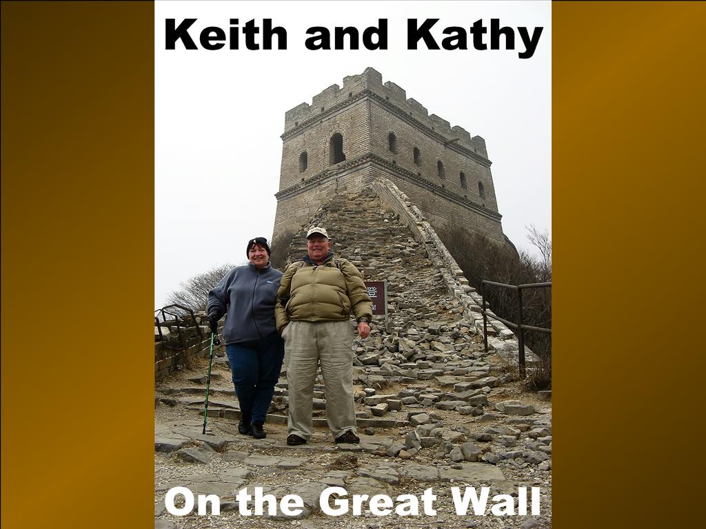
Where in the World are Keith and Kathy


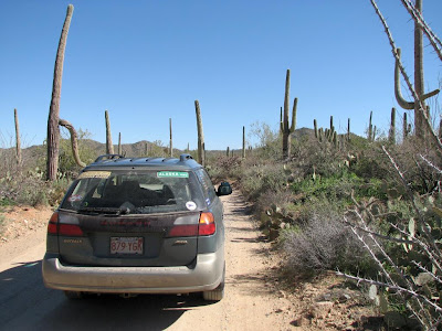
Since our last blog from Casa Grande, Arizona, we have moved on to the Riverside Casino Campground in Laughlin, Nevada, by way of the Escapees North Ranch Co-op in Congress, AZ. Along the way we drove past breath-taking desert scenery. Among the most beautiful ( in our opinion ) are the Saguaro Cactus and the Joshua Tree.


Sauguaro Cacti Hillside


Joshua Tree Grove


We drove through Phoenix and passed many of the Spring Training Facilities of the Cactus League. More than a dozen major league baseball teams have their spring traing in the Phoenix ara.


Phoenix Skyline


Phoenix Bridge Decoration


We liked the Casa Grande area very much, so much so that we stayed too long and were forced to hurry through the delightful mountain scenery along US 93 in west central Arizona. We also regret spending only one night at North Ranch, which is an excellent facility with friendly people and breathtaking desert views. Keith was especially pleased that they let him change oil in the campsite; many campgrounds prohibit oil changing. There is a campground in Tok, Alaska which advertises a $200 fine and expulsion if caught changing oil on the premises.

Congress, AZ Sunrise


From Congress to Laughlin the landscape changed dramatically with more rock formations.


Lava Plugs


In Laughlin we stayed at the Riverside RV Campground. The campground in Bullhead, Az on the river seemed much more inviting. Next time we’ll stay there.
Kathy’s money regrets being left behind, lonely and forlorn, at the Riverside Casino in Laughlin. The Riverside dinner buffet also was disappointing at 2-1/2 COW’s. On the flip side, we enjoyed an excellent breakfast buffet at the Pioneer Casino; 3-1/2 COW’s. Unfortunately, Kathy left more money there.

Approaching Laughlin


Money Trap

Sunday, February 24, 2008

Casa Grande, AZ and Saguaro National Park

Where in the World are Keith and Kathy?

The past two weeks we have been parked in Casa Grande, Arizona. Some photos of the southern Arizona landscape around Casa Grande are provided below:

Soutern Arizona Landscape

Agriculture in Southern Arizona

Southern Arizona Skyscape


The first five nights in Casa Grande, we were parked at the Pinal County Fairgrounds with 250 other RV’s, attending the second annual western area Gypsy Rally. “What do you do at a rally?” you may be asking yourself. Well, it depends on who sponsors the rally. The excellent Gypsy Rally focused primarily on RV education, targeted at extended and full time Rvers who already know the basics. Seminars included such topics fire safety, driver training, tire pressure monitors, creative writing, RV New Zeeland, bloging basics, etc.

This blog is a result of the latter seminar, presented by a husband and wife team doing business as Geeks on Tour, http://www.geeksontour.com/ . In this extremely well presented tutorial we learned what a blog is, and how to create one using a free service provided by Google. Another outstanding seminar, presented by Dave Baleria, covered all aspects of membership campgrounds, including all the traps. There are some good companies out there, but the procurement process can be a minefield.

The rally also featured a wide variety of vendors, ranging from arts & crafts, to RV accessories, to books and software products. Coffee and donuts were provided every morning, and some sort of evening activity was offered every night, including a pizza party.

We left the muddy fairgrounds parking area Thursday evening, just ahead of the rain, and moved to Rovers Roost, a beautiful SKP Co-op park on the west side of Casa Grande. Saturday morning Kathy flew to Massachusetts to visit her grandchildren. Keith spent the week mostly doing camper cores such as carpet cleaning, etc. However, he did take a day off to visit the nearby Saguaro National Park.
The Saguaro Cactus, with it’s thick central barrel and upright side arms, is an icon of the southwestern desert because of it’s distinctive appearance:

Desert Icon


Despite it’s iconic status, the Saguaro has a limited range, and can be seen in relatively few places. The Saguaro National Park, just outside of Tuscon, contains an interesting and unusual collection of plant and animal life, dominated by the namesake plant. With summer temperatures over 100F, February is definitely the time to visit. There are two sections of the park (east and west), both with excellent visitors centers. Keith visited the west section. After stopping at the visitors center, he drove a gravel road through the mountains back to Tuscon, stopping to snap photos frequently. A few of the pix are provided below.

Our next stop is a NASCAR event at the Las Vegas Motor Speedway. Stay tuned.

Yellow Highway Marker

Suguaro National Park (west) Visitors Center

Creosote Bush, Prickly Pear, Cholla, and Suguaro

Cholla

Barrel Blooms

Exploring the Outback

Descending into Tuscon

Saturday, February 9, 2008

Gunfight at the OK Corral


Where in the World are Keith and Kathy?


The morning after our visit to New Mexico's White Sands, we rolled westbound across the Rio Grand River, and on into Arizona. We stopped two nights at the SKP Saguaro Campground in Benson, AZ. This beautiful desert park is situated on an eastern facing slope, with a breathtaking view of the Dragoon Pass. Sign on the laundry room door says “Please keep door closed, as there are snakes in the area".


View from the Campground


The next morning we drove south to Tombstone, AZ, site of the gunfight at the OK corral. Celebration of this historic battle between the Earps and the Clantons seems to be the primary raison detre for this town. The main street of the old town is closed to cars, and horse drawn stagecoaches roll up and down the street. There is a museum at the OK Corral, and the gunfight is reenacted every day at 2pm. The good news is, we were there in the morning, so did not have to witness this spectacle. We did listen to an amusing demonstration of the game of Faroe by Doc Holliday. Photos of this entertainment may be seen at the end of this post.

Following this shtick we drove to a town name Sierra Vista, where we dined at a surprisingly good Korean restaurant. Kathy had ribs, while Keith had pan fried squid in hot sauce. Served on the side was the usual assortment of pickled veggies, including Kim chee, a signature Korean dish consisting of cabbage marinated in hot pepper and fish oil. Delicious! 3-1/2 Cows.

The next morning we raised anchor and motored northwest to Casa Grande, AZ, where we will camp for five nights at the Gypsy Journal Rally. The Gypsy Journal (http://www.gypsyjournal.net/) is a newsletter published bi-monthly by a wanderer/entrepeneur named Nick Russell, who travels around the country and writes about the places he visits. Keith devours every issue of this newsletter, and has been anxious to attend one of Nick’s rallies.

Stay tuned to learn all about it.


The Promise


The Reality - It's Manakins


Ticket to Ride


Amusing Faroe Demonstration by Doc Holliday

Thursday, February 7, 2008

White Sands National Monument and Missle Test Range

Where in the World are Keith & Kathy?


Returning from our interplanetary voyage in Roswell, we re-entered the real world of Slow-Coach travel. The journey westbound over the pass through the San Francisco Mountains in southern New Mexico was highly scenic, in a deserty sort of way. Seems there is desert scenery, and then there is desert scenery. The desert country around Roswell was flat, scrubby. On the other hand, the drive up through the canyon to the Carlsbad Caverns was quite scenic, with colorful rock strata and varied & interesting plant life, primarily various varieties of cactus. Likewise, the drive over the pass to Alamogordo, New Mexico was very scenic and pleasant, culminating in a distant view of the White Sands as we descended into town. Driving through the pass, we saw snow.


Westbound from Roswell - San Francisco Mountains in the Distance


Snow in the San Francisco Mountains


White Sands in View


The white sands are dunes of gypsum (calcium sulfate) sand (vs. ordinary silica sand), blown northeastward from the bed of a dry lake. The National Park Service has a visitors center and maintains a road through the brilliantly white dunes. We traversed this road late in the afternoon, gaining the advantage of oblique lighting which creates stark contrasts of light and shadow, and highlights the natural contours of the windblown sand. One of the interesting characteristics of the dunes is the survival of desert flora and fauna, despite being burried under the blowing gypsum sands.


White Sands National Monument


Desert Vegetation Buried in White Sand


White Sands National Monument is located entirely within the White Sands Missile Test Range, operated jointly by the Army, Navy, Air Force, and NASA. NASA maintains a backup shuttle landing strip here, which was utilized once when both Edwards and the Cape were unavailable due to weather. There is a really neat museum at the main entrance to the base, which we visited the morning after our trip to the National Monument. Numerous missiles are displayed outside the museum. Inside are historical exhibits of missile test gear, as well as of cultural artifacts from Indian times, and from the period of western settlement. In the northern sector of the base, about 50 miles from the visitors center, is the Trinity test site, where the first atom bomb was tested. Because of ongoing test activity, this site is opened to the public only two days a year, April 1 and October 1. Being there in February, we did not get to visit this site. Interestingly, a major US highway traverses the test grounds. Just outside of Alamogordo, there is a large sign with flashing lights, warning that the highway may be closed periodically due to missle test activity.


Mixed Use Highway


Missle Test Facilities


Fair Warning


Missle Museum


It is interesting that in this vast, open country with 80mph speed limits, one thinks nothing of popping 50 miles down the road from the campground to visit a museum. On our way back, we saw a couple of interesting looking birds circling over the highway. Kathy thought them to be hawks. Keith decided they must be F 117 stealth fighters when they landed at the nearby Holloman Air Force Base.

Following a stop at the local WM Supercenter for comestibles, be bedded down in preparation for the next days journey west into Arizona. Stay tuned.

Wednesday, February 6, 2008

Carlsbad Caverns & Surroundings

Where In The World are Keith & Kathy?


The morning following our tire debacle in West Texas, we motored north about 100 miles to Carlsbad, NM. We checked in at The Ranch, a small SKP Co-op in Lakewood, NM. The Ranch is a clean and very friendly park, but suffers from being located in a less scenic part of the southeastern New Mexico desert. Not unattractive by any means, but not as scenic as other parks in the SKP system. Nonetheless, we would not hesitate to park here for a week or so, because the people are so nice. See below for some of our photos of West Texas and Southeast New Mexico

After setting up camp (this means disconnecting the car, parking, and plugging in the electric cord), we headed to Carlsbad Caverns National Park. The visitors center was closed for remodeling, but the cave was open for touring.

First, lets get something straight. Keith does not like caves. He is mildly claustrophobic, and can’t get it out of the back of his mind that he is 750 feet underground. This phobia notwithstanding, the caverns are truly impressive, both for their size, extent, and torturous morphology, and for the many and varied formations (spelioforms, in cave lingo) caused by evaporation of mineral laden water seepage. We glimpsed a cave Troll, and heard the tap-tap of Orc hammers, but did not spot a Balrog, thanks to the good efforts of the Wizard Gandalf, who defeated the last known specimen. The road to the caves is very scenic, as seen below.


Road to the Carlsbad Caverns


Prickly Pear Cactus seen on the Road to the Caverns


Yucca Seen on the Road to the Caverns


View from the Carlsbad Caverns Visitors Center


Cave Troll


We enjoyed a late lunch at a Chinese buffet on the way back to the Ranch (2-1/2 Cows), then crashed for the evening, in preparation for a visit to the intergalactic space terminal the next morning in Roswell, NM.

Roswell , NM is the site of a supposedly 1946 crash of an alien spacecraft on the outskirts of the city. For years this was the city’s claim to fame but in recent years the Chamber of Commerce has worked very hard to change its one-sided image. However our destination was the UFO Museum in Roswell, where the street lights are shaped as the heads of Alien beings. The museum is as hokey as you would expect with all the “Top Secret” documents and interviews from people who witnessed the space crash.


Roswell Emporium


Roswell Space Tourist


Where it all Happens in Roswell


During our tour Kathy examined everything and Keith selectively viewed a couple of exhibits that interested him. The gift shop was filled with unusual gifts. We left after purchasing a T-shirt and jar of Hot salsa.

Another highlight of our visit to Roswell was a Mexican bakery (4 COWS) . The pastry was fresh and delicious!


Shown below are some general views in West Texas and Southeastern New Mexico:


Leaving the Texas Hill Country


West Texas Windmill Farm


West Texas State Tree


New Mexico Skyscape


Guadalupe Mountains